Vertic is quad tail-sitter vertical take off-landing (VTOL) mappping drone that easy to control, fully autonomous, and capable operate from narrow site. Vertic is ready for various application such as agriculture, urban planning, plantation, mining, forestry, and oil & gas
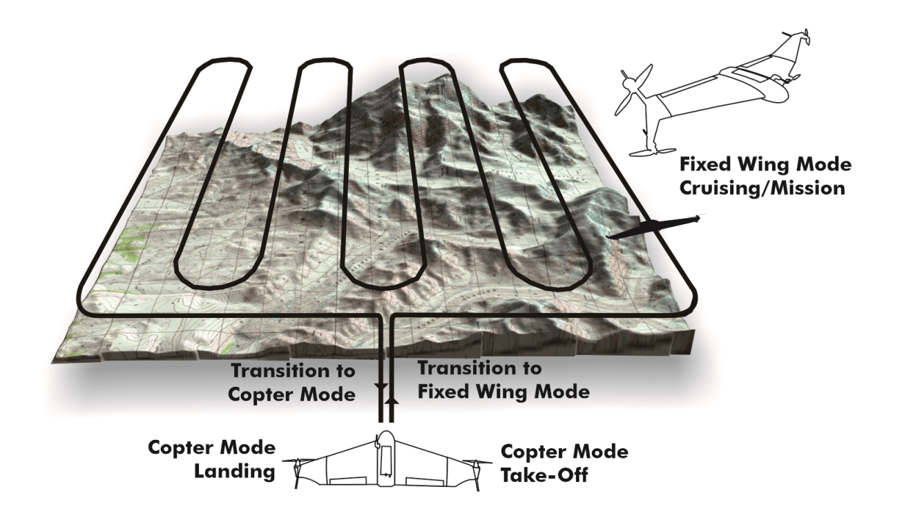
Vertic can take-off vertically in copter mode from a very narrow space. Vertic ascend to safe altitude and transition to fixed-wing mode for efficiency. After finishing the mission, Vertic return to pre-defined home position, transition to copter mode, and land.
2x2m minimum take-off & landing site
Safe in-the-air catch landing
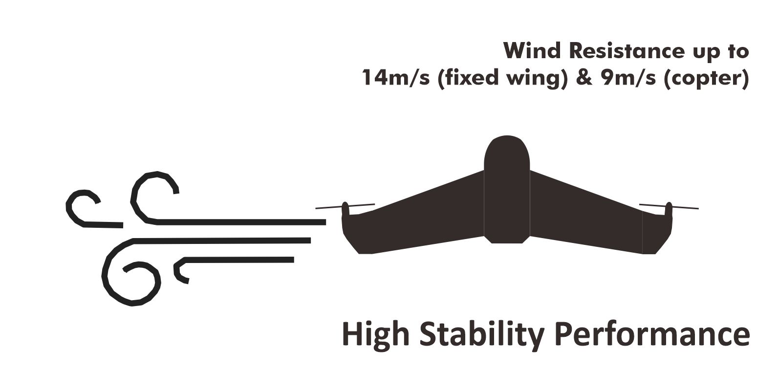
Wind resistance
High Stability
Vertic is design with high stability performance. Ensure flight readiness, even in windy condition. Wind resist:
Fixed-wing mode: 14m/s
Copter mode: 9m/s
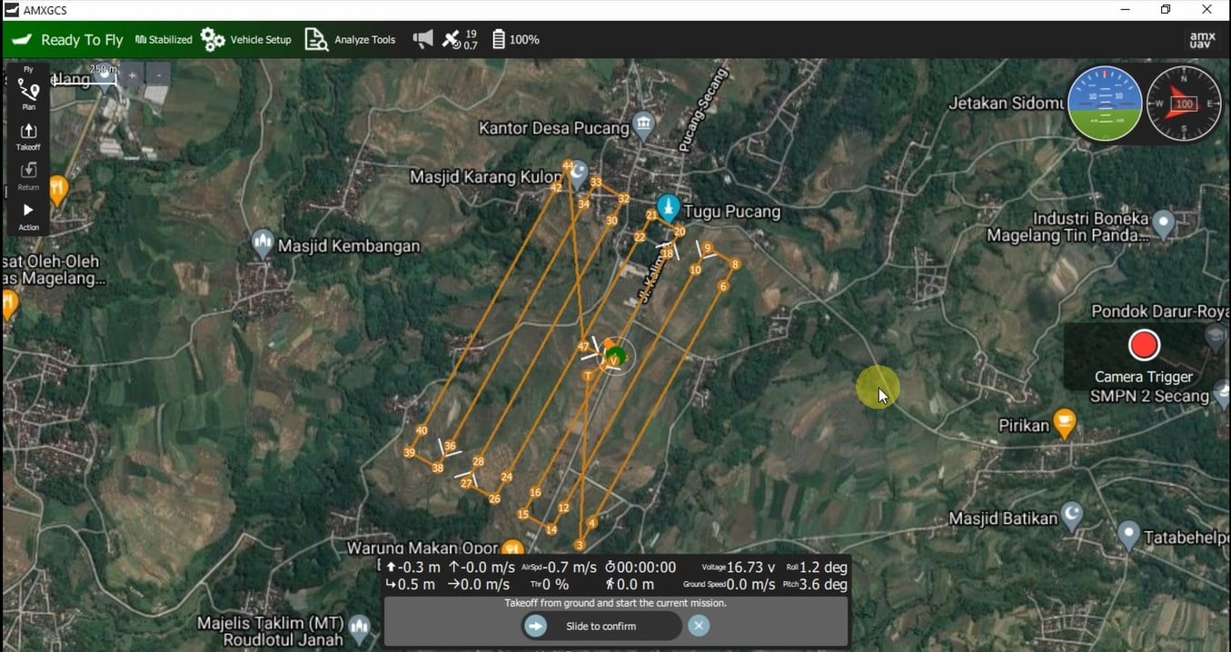
Ground control software
User Friendly
AMXGCS is user friendly ground control software, specially customized for Vertic.
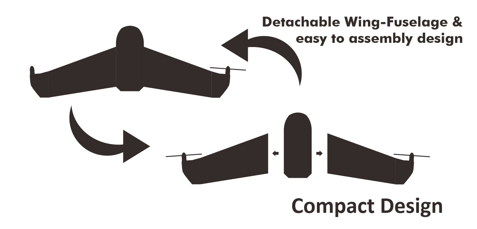
design
Compact
Vertic design is very compact, made from light adn strong composites material. Vertic’s wing-fuselage is detachable for easy to transport.
Wingspan: 1400 mm
Length: 500 mm
Height: 450 mm
Weight: 3500 gram
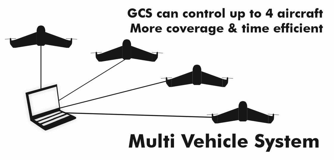
Expandable coverage
MVS
Multi vehicle system (MVS) enable 4 unit of Vertic fly together and control only by 1 ground control system. Improve mapping capacity up to 1200Ha/hour
Deliver data with confident
Vertic: Tools for Overclock Your Business
Vertic is the best VTOL Mapping drone in its class both in performance and price. Talk to our sales team immediately for demo flight and quotation request.